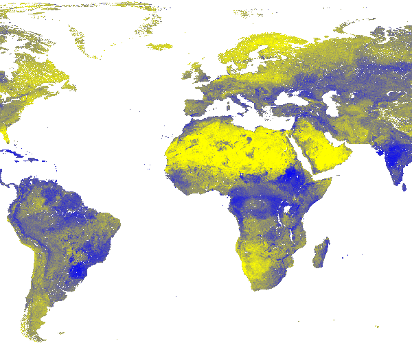
SoilGrids250m 2017-03 - Clay content (0-2 micro meter) mass fraction
Clay content (0-2 micro meter) mass fraction in % at 7 standard depths predicted using the global compilation of soil ground observations. Accuracy assessement of the maps is availble in Hengl et at. (2017) DOI: 10.1371/journal.pone.0169748. Data provided as GeoTIFFs with internal compression (co='COMPRESS=DEFLATE'). Measurement units: w%.
Simple
- Date (Publication)
- 2017-06-01
- Citation identifier
- 20f6245e-40bc-4ade-aff3-a87d3e4fcc26
- Presentation form
- Digital map
- Status
- Completed
- Point of contact
-
Organisation name Individual name Electronic mail address Role ISRIC - World Soil Information
Bas Kempen
Principal investigator ISRIC - World Soil Information
Tom Hengl
None
Author
- Theme
-
-
clay
-
digital soil mapping
-
-
Stratum
-
-
Soil science
-
-
Region
-
-
Global
-
- Access constraints
- License
- Use constraints
- License
- Other constraints
- Open Database License (ODbl) v1.0
- Spatial representation type
- Grid
- Distance
- 250 m
- Language
- English
- Character set
- UTF8
- Topic category
-
- Geoscientific information
- Begin date
- 1950-01-01
- End date
- 2015-12-01
N
S
E
W
))
- Reference system identifier
- EPSG / 4326
- Distribution format
-
Name Version GTiff
Digital transfer options
- OnLine resource
- Hierarchy level
- Dataset
Metadata
- File identifier
- 20f6245e-40bc-4ade-aff3-a87d3e4fcc26 XML
- Metadata language
- English
- Character set
- UTF8
- Hierarchy level
- Dataset
- Hierarchy level name
-
dataset
- Date stamp
- 2021-07-14T11:52:38
- Metadata standard name
-
ISO 19115:2003/19139
- Metadata standard version
-
2003/Cor.1:2006
- Metadata author
-
Organisation name Individual name Electronic mail address Role ISRIC - World Soil Information
Data infodesk
Point of contact
)))
