INFOSOLO - Soil Profile Data for Portugal
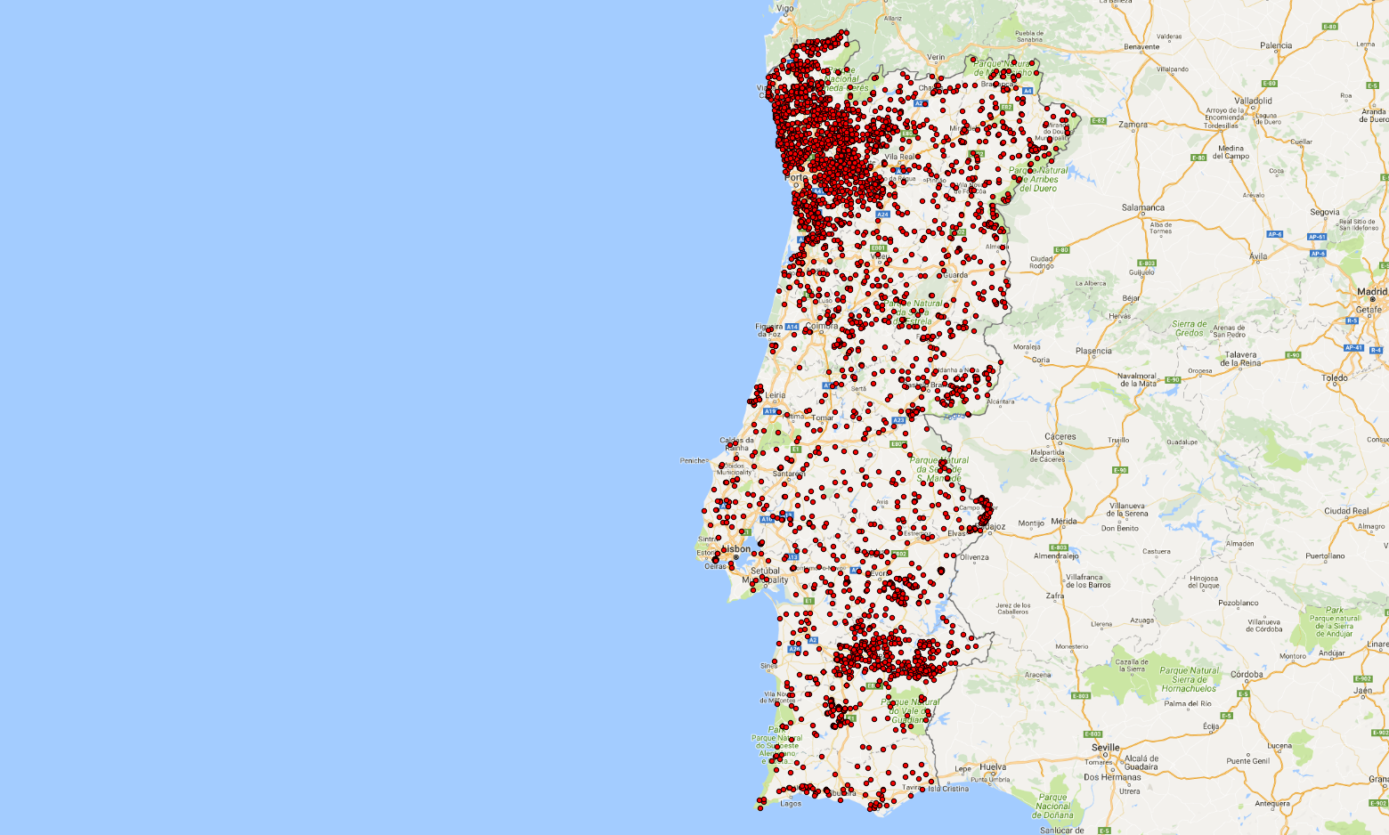
The INFOSOLO legacy database is the first effort to develop a soil information system in Portugal, suitable to compile soil data produced in the country, and to support stakeholders and land managers in decision-making. The current version includes soil data from a set of 9934 horizons/layers studied in 3461 soil profiles across the country between 1966 and 2014. Data was extracted from scattered soil surveys, research projects, and academic studies carried out by public Portuguese and other European institutions. As the level of detail of soil information varied between datasets, a series of validation tests and harmonization procedures were implemented in order to access and improve the quality of the data
Simple
- Date (Publication)
- 2006-11-01
- Citation identifier
- 25d0cf4d-1865-4d2a-be32-40a1b2483936
- Presentation form
- Digital map
- Status
- Completed
- Point of contact
-
Organisation name Individual name Electronic mail address Role National Institute of Agricultural and Veterinary Research (Instituto Nacional de Investigação Agrária e Veterinária)
Maria da Conceição Gonçalves
Author Universidade de Lisboa - Instituto Superior Técnico - Marine, Environmental and Technology Center (MARETEC)
Tiago Ramos
Author
- Theme
-
-
calcium
-
calcium carbonate
-
phosphorus
-
cation exchange capacity
-
magnesium
-
nitrogen
-
organic carbon
-
potassium
-
sodium
-
bulk density
-
soil depth
-
pH
-
texture
-
water holding capacity
-
soil profiles
-
nutrients
-
-
Stratum
-
-
Soil science
-
-
Region
-
-
Europe
-
Portugal
-
- Access constraints
- License
- Use constraints
- License
- Other constraints
-
Attribution 4.0 International (CC BY 4.0), https://creativecommons.org/licenses/by/4.0/
- Spatial representation type
- Vector
- Denominator
- 10000
- Language
- English
- Character set
- UTF8
- Topic category
-
- Geoscientific information
- Begin date
- 1966-01-01
- End date
- 2014-12-12
))
- Reference system identifier
- EPSG / 4326
- Distribution format
-
Name Version zip
Digital transfer options
- OnLine resource
-
Protocol Linkage Name OGC:WFS
https://maps.isric.org/mapserv?map=/map/external.map pt_infosolo
WWW:LINK-1.0-http--related
https://doi.org/10.1016/j.catena.2017.07.020 Scientific paper
WWW:LINK-1.0-http--related
https://files.isric.org/public/external/PT-INFOSOLO.zip Download zip
- Hierarchy level
- Dataset
Metadata
- File identifier
- 25d0cf4d-1865-4d2a-be32-40a1b2483936 XML
- Metadata language
- English
- Character set
- UTF8
- Hierarchy level
- Dataset
- Hierarchy level name
-
dataset
- Date stamp
- 2021-11-18T15:06:44
- Metadata standard name
-
ISO 19115:2003/19139
- Metadata standard version
-
2003/Cor.1:2006
- Metadata author
-
Organisation name Individual name Electronic mail address Role ISRIC - World Soil Information
Data infodesk
Point of contact
)))
