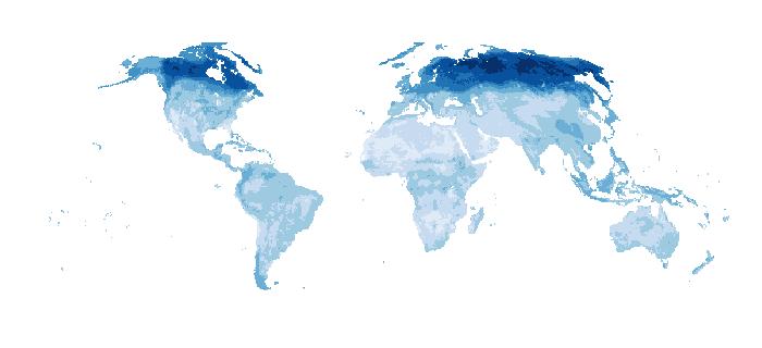
SoilGrids250m 2.0 - Volumetric Water Content at 10kPa aggregated 5000m
Volumetric Water Content at 10kPa suction in 10-3 cm3cm-3 (0.1 v% or 1 mm/m) at 6 standard depths. Predictions were derived using a digital soil mapping approach based on Quantile Random Forest, drawing on a global compilation of soil profile data and environmental layers. This map is the result of resampling the mean SoilGrids 250 m predictions (Turek et al. 2021) for each 5000 m cell.
Simple
- Date (Publication)
- 2021-11-05
- Citation identifier
- 2be1c098-b2b6-40ab-94b5-86674ad9f4cb
- Citation identifier
- doi: / https://doi.org/10.17027/isric-soilgrids/2be1c098-b2b6-40ab-94b5-86674ad9f4cb
- Presentation form
- Digital map
- Status
- Completed
- Point of contact
-
Organisation name Individual name Electronic mail address Role ISRIC - World Soil Information
Laura Poggio
Point of contact ISRIC - World Soil Information
Maria Eliza Turek
Author ISRIC - World Soil Information
Niels Batjes
Author ISRIC - World Soil Information
Gerard Heuvelink
Author ISRIC - World Soil Information
Luis de Sousa
Author ISRIC - World Soil Information
Data infodesk
Point of contact
- Theme
-
-
Volumetric Water Content
-
digital soil mapping
-
-
Stratum
-
-
Soil science
-
-
Region
-
-
Global
-
- Access constraints
- License
- Use constraints
- License
- Other constraints
-
Attribution 4.0 International (CC BY 4.0), https://creativecommons.org/licenses/by/4.0/
- Spatial representation type
- Grid
- Distance
- 5000 m
- Language
- English
- Character set
- UTF8
- Topic category
-
- Geoscientific information
- Begin date
- 1905-04-01
- End date
- 2016-07-05
))
- Reference system identifier
- proj4 / +proj=igh +datum=WGS84 +no_defs +towgs84=0,0,0
- Distribution format
-
Name Version image/tiff; application=geotiff+cog
- Distributor contact
-
Organisation name Individual name Electronic mail address Role ISRIC - World Soil Information
Publisher
- Distributor contact
-
Organisation name Individual name Electronic mail address Role ISRIC - World Soil Information
Publisher
Digital transfer options
- OnLine resource
-
Protocol Linkage Name WWW:LINK-1.0-http--related
https://isric.org/explore/soilgrids Project webpage
WWW:LINK-1.0-http--related
https://www.isric.org/explore/soilgrids/faq-soilgrids FAQ
WWW:LINK-1.0-http--related
https://meetingorganizer.copernicus.org/EGU21/EGU21-15548.html Scientific publication (Turek et al. 2021)
WWW:LINK-1.0-http--related
https://files.isric.org/soilgrids/latest/data_aggregated/ Download (WebDAV)
- Hierarchy level
- Dataset
Metadata
- File identifier
- 2be1c098-b2b6-40ab-94b5-86674ad9f4cb XML
- Metadata language
- English
- Character set
- UTF8
- Parent identifier
-
SoilGrids250m 2.0 - Volumetric Water Content at 10kPa
c6cb5073-78dd-4d8d-be81-9d546a1c004f
- Hierarchy level
- Dataset
- Hierarchy level name
-
dataset
- Date stamp
- 2024-02-26T13:45:30
- Metadata standard name
-
ISO 19115:2003/19139
- Metadata standard version
-
2003/Cor.1:2006
- Metadata author
-
Organisation name Individual name Electronic mail address Role ISRIC - World Soil Information
Data infodesk
Point of contact
)))
