SOTER-based soil parameter estimates (SOTWIS) for Latin America and the Caribbean
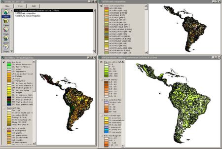
This harmonized set of soil parameter estimates for Latin America and the Caribbean was derived from a revised version of the 1:5M Soil and Terrain Database for the region (SOTERLAC, ver. 2.0) and the ISRIC-WISE soil profile database.
The land surface of Latin America and the Caribbean has been characterized using 1585 unique SOTER units, corresponding with 5855 polygons. The major soils have been described using 1660 profiles, selected by national soil experts as being representative for these units. The associated soil analytical data have been derived from soil survey reports. These sources seldom hold all the physical and chemical attributes ideally required by SOTER. Gaps in the measured soil profile data have been filled using a step-wise procedure that uses taxotransfer rules, based on about 9600 soil profiles held in the WISE database, complemented with expert-rules.
Parameter estimates are presented by soil unit for fixed depth intervals of 0.2 m to 1 m depth for: organic carbon, total nitrogen, pH(H2O), CECsoil, CECclay, base saturation, effective CEC, aluminium saturation, CaCO3 content, gypsum content, exchangeable sodium percentage (ESP), electrical conductivity of saturated paste (ECe), bulk density, content of sand, silt and clay, content of coarse fragments (less than 2 mm), and available water capacity (-33 to -1500 kPa). These attributes have been identified as being useful for agro-ecological zoning, land evaluation, crop growth simulation, modelling of soil carbon stocks and change, and analyses of global environmental change.
The current parameter estimates should be seen as best estimates based on the current selection of soil profiles and data clustering procedure. Taxotransfer rules have been flagged to provide an indication of the possible confidence in the derived data. Results are presented as summary files and can be linked to the 1:5M scale SOTERLAC map in a GIS, through the unique SOTER-unit code. The secondary data set is considered appropriate for studies at the continental scale (greater than 1:5M). Correlation of soil analytical data should be done more rigorously when more detailed scientific work is considered.
Simple
- Date (Publication)
- 2005-02-01
- Citation identifier
- 3a9ed87d-affc-4f72-aa6e-72db4fefec40
- Presentation form
- Digital map
- Status
- Completed
- Point of contact
-
Organisation name Individual name Electronic mail address Role ISRIC - World Soil Information
Niels Batjes
Author
- Theme
-
-
calcium
-
carbon
-
cation exchange capacity
-
electrical conductivity
-
nitrogen
-
organic matter
-
bulk density
-
soil profiles
-
pH
-
salinity
-
texture
-
water holding capacity
-
nutrients
-
-
Stratum
-
-
Soil science
-
-
Region
-
-
South America
-
Latin America
-
Caribbean
-
Argentina
-
Brazil
-
Belize
-
Bolivia
-
Caribbean Islands
-
Chile
-
Colombia
-
Costa Rica
-
Ecuador
-
El Salvador
-
French Guiana
-
Guatemala
-
Guiana
-
Honduras
-
Mexico
-
Nicaragua
-
Panama
-
Paraguay
-
Peru
-
Suriname
-
Uruguay
-
Venezuela
-
Cuba
-
Jamaica
-
Dominican Republic
-
Haiti
-
Trinidad and Tobago
-
- Access constraints
- License
- Use constraints
- License
- Other constraints
- Attribution 3.0 International (CC BY 3.0)
- Spatial representation type
- Vector
- Denominator
- 5000000
- Language
- English
- Character set
- UTF8
- Topic category
-
- Geoscientific information
- Begin date
- 1953-01-01
- End date
- 1998-08-01
))
- Reference system identifier
- EPSG / 4326
- Distribution format
-
Name Version zip
Digital transfer options
- OnLine resource
-
Protocol Linkage Name WWW:DOWNLOAD-1.0-ftp--download
https://files.isric.org/public/sotwis/SOTWIS_LAC.zip Download
WWW:LINK-1.0-http--related
https://isric.org/projects/harmonized-continental-soter-derived-database-sotwis Project webpage
WWW:LINK-1.0-http--related
https://isric.org/sites/default/files/isric_report_2005_02.pdf Report
- Hierarchy level
- Dataset
- Statement
-
1) Batjes NH 2000. Effects of mapped variation in soil conditions on estimates of soil carbon and nitrogen stocks for South America. Geoderma 97, 135-144
2) Batjes NH 2005. SOTER-based soil parameter estimates for Latin America and the Caribbean (ver. 1.0). Report 2005/02, ISRIC - World Soil Information, Wageningen,, https://isric.org/sites/default/files/isric_report_2005_02.pdf
3) Batjes NH, Al-Adamat R, Bhattacharyya T, Bernoux M, Cerri CEP, Gicheru P, Kamoni P, Milne E, Pal DK and Rawajfih Z 2007. Preparation of consistent soil data sets for SOC modelling purposes: secondary SOTER data sets for four case study areas. Agriculture, Ecosystems and Environment 112, 26-34
4) Dijkshoorn JA, Huting JRM and Tempel P 2005. Update of the 1:5 million Soil and Terrain Database for Latin America and the Caribbean (SOTERLAC, ver. 2.0). Report 2005/01, ISRIC - World Soil Information, Wageningen.
5) FAO, ISRIC, UNEP and CIP 1998. Soil and terrain digital database for Latin America and the Caribbean at 1:5 million scale. Land and Water Digital Media Series No. 5, Food and Agriculture Organization of the United Nations, Rome
Metadata
- File identifier
- 3a9ed87d-affc-4f72-aa6e-72db4fefec40 XML
- Metadata language
- English
- Character set
- UTF8
- Hierarchy level
- Dataset
- Hierarchy level name
-
dataset
- Date stamp
- 2021-07-14T11:52:05
- Metadata standard name
-
ISO 19115:2003/19139
- Metadata standard version
-
2003/Cor.1:2006
- Metadata author
-
Organisation name Individual name Electronic mail address Role ISRIC - World Soil Information
Data infodesk
Point of contact
)))
