Soil and Terrain Database (SOTER) for Latin America and the Caribbean (SOTERLAC), version 2.0
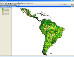
The Soil and Terrain database for Latin America and the Caribbean (SOTERLAC), version 2.0, at scale 1:5 million, replaces version 1.02. The update includes changes in the GIS file and in the attributes database. The topographic base of the SOTERLAC map was adapted to a version congruent to the Digital Chart of the World.
The SOTERLAC attribute database has changed in respect to the number of ... pedon attributes that can be stored. Contrary to the preceding, compact version, version 2.0 can accommodate all pedon attributes considered in a 1:1 million scale SOTER database.
SOTERLAC forms a part of the ongoing activities of ISRIC, FAO and UNEP to update the world's baseline information on natural resources.The project involved collaboration with national soil institutes from the countries in the region as well as individual experts
Simple
- Date (Publication)
- 2005-07-01
- Citation identifier
- 436bd4b0-7ffc-4272-be57-686b7d7eea7d
- Presentation form
- Digital map
- Status
- Completed
- Point of contact
-
Organisation name Individual name Electronic mail address Role ISRIC - World Soil Information
Bas Kempen
Point of contact ISRIC - World Soil Information
J.A. Dijkshoorn
None
Author ISRIC - World Soil Information
Jan R.M. Huting
None
Author
- Theme
-
-
calcium
-
carbon
-
cation exchange capacity
-
electrical conductivity
-
nitrogen
-
organic matter
-
bulk density
-
soil profiles
-
pH
-
salinity
-
texture
-
water holding capacity
-
nutrients
-
-
Stratum
-
-
Soil science
-
-
Region
-
-
South America
-
Latin America
-
Caribbean
-
Argentina
-
Brazil
-
Belize
-
Bolivia
-
Caribbean Islands
-
Chile
-
Colombia
-
Costa Rica
-
Ecuador
-
El Salvador
-
French Guiana
-
Guatemala
-
Guiana
-
Honduras
-
Mexico
-
Nicaragua
-
Panama
-
Paraguay
-
Peru
-
Suriname
-
Uruguay
-
Venezuela
-
Cuba
-
Jamaica
-
Dominican Republic
-
Haiti
-
Trinidad and Tobago
-
- Access constraints
- License
- Use constraints
- License
- Other constraints
- Attribution 3.0 International (CC BY 3.0)
- Spatial representation type
- Vector
- Denominator
- 5000000
- Language
- English
- Character set
- UTF8
- Topic category
-
- Geoscientific information
- Begin date
- 1953-01-01
- End date
- 1998-08-01
))
- Reference system identifier
- EPSG / 4326
- Distribution format
-
Name Version zip
Digital transfer options
- OnLine resource
-
Protocol Linkage Name WWW:DOWNLOAD-1.0-ftp--download
https://files.isric.org/public/soter/LAC-SOTER.zip Download
WWW:LINK-1.0-http--related
https://isric.org/index.php/projects/soil-and-terrain-soter-database-programme Project webpage
WWW:LINK-1.0-http--related
https://isric.org/sites/default/files/isric_report_2005_01.pdf Report
- Hierarchy level
- Dataset
- Statement
-
1) Dijkshoorn JA, Huting JRM and Tempel P 2005. Update of the 1:5 million Soil and Terrain Database for Latin America and the Caribbean (SOTERLAC, ver. 2.0). Report 2005/01, ISRIC - World Soil Information, Wageningen,
https://isric.org/sites/default/files/isric_report_2005_01.pdf
2) Batjes NH 2000. Effects of mapped variation in soil conditions on estimates of soil carbon and nitrogen stocks for South America. Geoderma 97, 135-144, http://dx.doi.org/10.1016/S0016-7061(00)00031-8
3) Batjes NH 2005. SOTER-based soil parameter estimates for Latin America and the Caribbean (ver. 1.0). Report 2005/02, ISRIC - World Soil Information, Wageningen, https://isric.org/sites/default/files/isric_report_2005_02.pdf
4) FAO, ISRIC, UNEP and CIP 1998. Soil and terrain digital database for Latin America and the Caribbean at 1:5 million scale (ver. 1.0). Land and Water Digital Media Series No. 5, Food and Agriculture Organization of the United Nations, Rome
Metadata
- File identifier
- 436bd4b0-7ffc-4272-be57-686b7d7eea7d XML
- Metadata language
- English
- Character set
- UTF8
- Hierarchy level
- Dataset
- Hierarchy level name
-
dataset
- Date stamp
- 2021-07-14T11:51:59
- Metadata standard name
-
ISO 19115:2003/19139
- Metadata standard version
-
2003/Cor.1:2006
- Metadata author
-
Organisation name Individual name Electronic mail address Role ISRIC - World Soil Information
Data infodesk
Point of contact
)))
