Soil and Terrain Database for Kenya (KENSOTER), version 2.0
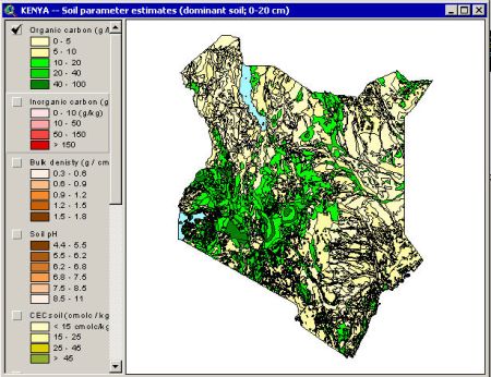
The Soil and Terrain database for Kenya (KENSOTER), version 2.0, at scale 1:1 million, replaces version 1.0 . The update include changes in the GIS file and in the attribute database. The topographic base of KENSOTER was adapted to a version congruent to the Digital Chart of the World. The KENSOTER attribute database has changed with respect to the number of pedons stored and pedon attributes. The KENSOTER version 2.0 database contains a number of measured soil moisture contents at various tensions.
Simple
- Date (Publication)
- 2004-02-01
- Citation identifier
- 73e27136-9efe-49e4-af35-fd98b841d467
- Presentation form
- Digital map
- Status
- Completed
- Point of contact
-
Organisation name Individual name Electronic mail address Role ISRIC - World Soil Information
Bas Kempen
Point of contact Kenya Agricultural Research Institute
Peter N Macharia
Author
- Theme
-
-
calcium
-
carbon
-
cation exchange capacity
-
electrical conductivity
-
nitrogen
-
organic matter
-
bulk density
-
soil profiles
-
pH
-
salinity
-
texture
-
water holding capacity
-
nutrients
-
-
Stratum
-
-
Soil science
-
-
Region
-
-
Africa
-
East-Africa
-
Kenya
-
- Access constraints
- License
- Use constraints
- License
- Other constraints
- Attribution 3.0 International (CC BY 3.0)
- Spatial representation type
- Vector
- Denominator
- 1000000
- Language
- English
- Character set
- UTF8
- Topic category
-
- Geoscientific information
- Begin date
- 1972-01-01
- End date
- 2003-04-01
))
- Reference system identifier
- EPSG / 4326
- Distribution format
-
Name Version zip
Digital transfer options
- OnLine resource
-
Protocol Linkage Name WWW:DOWNLOAD-1.0-ftp--download
https://files.isric.org/public/soter/KE-SOTER.zip Download
WWW:LINK-1.0-http--related
https://isric.org/projects/soil-and-terrain-soter-database-programme Project webpage
WWW:LINK-1.0-http--related
https://isric.org/sites/default/files/isric_report_2004_01.pdf Report
- Hierarchy level
- Dataset
- Statement
-
The KENSOTER dataset 1:1 million was compiled in 1996 by the Kenya Soil Survey with technical backstopping and training provided by ISRIC -World Soil Information. The compilation was based on the - Exploratory Soil Map and Agro-Climatic Zone Map of Kenya-, scale 1:1 million (KSS 1982) and the many described and analysed soil profiles in KSSs database system. The database has been updated by (Batjes NH and Gicheru P 2004) and subsequently used for the sequestration of organic carbon stocks in soils at national level (GEF-SOC project). In 2007 the dataset was updated in respect of attribute data for the Green Water Credit project in the Upper Tana River catchment.
Metadata
- File identifier
- 73e27136-9efe-49e4-af35-fd98b841d467 XML
- Metadata language
- English
- Character set
- UTF8
- Hierarchy level
- Dataset
- Hierarchy level name
-
dataset
- Date stamp
- 2021-07-14T11:52:39
- Metadata standard name
-
ISO 19115:2003/19139
- Metadata standard version
-
2003/Cor.1:2006
- Metadata author
-
Organisation name Individual name Electronic mail address Role ISRIC - World Soil Information
Data infodesk
Point of contact
)))
