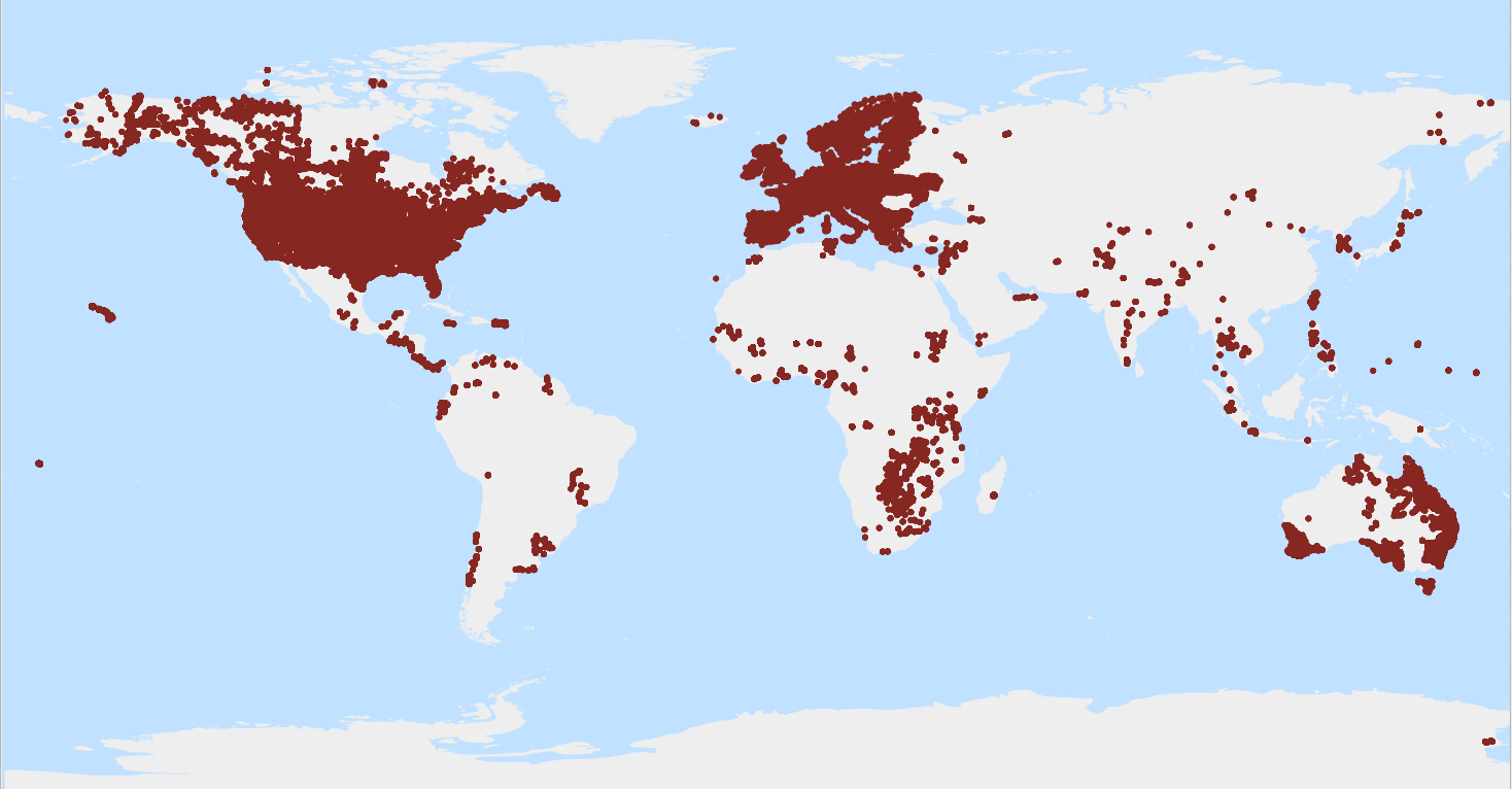
WoSIS latest - pH CaCl2
A measure of the acidity or alkalinity in soils, defined as the negative logarithm (base 10) of the activity of hydronium ions (H+) in a CaCl2 solution, as specified in the analytical method descriptions.
WoSIS_latest is a 'dynamic dataset' that contains the most recent complement of quality-assessed and standardised soil data served from WoSIS (ISRIC World Soil Information Service). The source data were shared by a wide range of data providers (see: https://www.isric.org/explore/wosis/wosis-contributing-institutions-and-experts).
Being dynamic, the contents of 'wosis_latest' will change once new point data are acquired, cleansed and standardised, additional soil properties are considered, and/or when possible amendments are required.
Static snapshots of 'wosis_latest' are released at irregular intervals for consistent citation purposes and to discuss methodological changes; the last snapshot is available at https://doi.org/10.5194/essd-16-4735-2024.
For general information about WoSIS please see the FAQ-page at https://www.isric.org/explore/wosis/faq-wosis.
Simple
- Date (Publication)
- 2020-05-01
- Citation identifier
- 76bb6ba1-35ca-4830-9539-95579444ef24
- Presentation form
- Digital map
- Status
- On going
- Point of contact
-
Organisation name Individual name Electronic mail address Role ISRIC - World Soil Information
Luis de Sousa
Author ISRIC - World Soil Information
Data infodesk
Point of contact ISRIC - World Soil Information
Niels Batjes
Author ISRIC - World Soil Information
Luis Calisto
Author
- Theme
-
-
pH
-
soil profiles
-
-
Stratum
-
-
Soil science
-
-
Region
-
-
Global
-
- Access constraints
- License
- Use constraints
- License
- Other constraints
-
Licenced per profile, as specified by data provider and indicated in the data
- Spatial representation type
- Vector
- Denominator
- 100000
- Language
- English
- Character set
- UTF8
- Topic category
-
- Geoscientific information
- Begin date
- 1918-01-01
- End date
- 2013-02-12
))
- Reference system identifier
- EPSG / 4326
- Distribution format
-
Name Version CSV
- Distributor contact
-
Organisation name Individual name Electronic mail address Role ISRIC - World Soil Information
Digital transfer options
- OnLine resource
-
Protocol Linkage Name OGC:WFS
https://maps.isric.org/mapserv?map=/map/wosis_latest.map :wosis_latest_phca
WWW:LINK-1.0-http--related
https://doi.org/10.5194/essd-16-4735-2024 Scientific paper
WWW:LINK-1.0-http--related
https://www.isric.org/explore/wosis/faq-wosis Project webpage
OGC:WMS
https://maps.isric.org/mapserv?map=/map/wosis_latest.map wosis_latest_phca
- Hierarchy level
- Dataset
Metadata
- File identifier
- 76bb6ba1-35ca-4830-9539-95579444ef24 XML
- Metadata language
- English
- Character set
- UTF8
- Hierarchy level
- Dataset
- Hierarchy level name
-
dataset
- Date stamp
- 2024-11-26T15:45:05
- Metadata standard name
-
ISO 19115:2003/19139
- Metadata standard version
-
2003/Cor.1:2006
- Metadata author
-
Organisation name Individual name Electronic mail address Role ISRIC - World Soil Information
Data infodesk
Point of contact
)))
