SOTER-based soil parameter estimates (SOTWIS) for Jordan
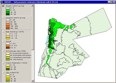
This harmonized set of soil parameter estimates has been developed using an updated 1:500 000 scale Soil and Terrain (SOTER) Database for Jordan. The associated soil analytical data were derived from soil survey reports. These sources seldom hold all the physical and chemical attributes ideally required by SOTER. Gaps in the measured soil profile data have been filled using a step-wise procedure that uses taxotransfer rules, based on about 9600 soil profiles held in the WISE database, complemented with expert-rules. Nineteeen parameter estimates are presented by soil unit for fixed depth intervals of 0.2 m to 1 m depth.
Simple
- Date (Publication)
- 2003-11-01
- Citation identifier
- 943d57ef-1eaf-4528-8508-9c81c1c2fcd3
- Presentation form
- Digital map
- Status
- Completed
- Point of contact
-
Organisation name Individual name Electronic mail address Role ISRIC - World Soil Information
Niels Batjes
Author
- Theme
-
-
calcium
-
carbon
-
cation exchange capacity
-
electrical conductivity
-
nitrogen
-
organic matter
-
bulk density
-
soil profiles
-
pH
-
salinity
-
texture
-
water holding capacity
-
nutrients
-
-
Stratum
-
-
Soil science
-
-
Region
-
-
Asia
-
Middle-East
-
Jordan
-
- Access constraints
- License
- Use constraints
- License
- Other constraints
- Attribution 3.0 International (CC BY 3.0)
- Spatial representation type
- Vector
- Denominator
- 500000
- Language
- English
- Character set
- UTF8
- Topic category
-
- Geoscientific information
- Begin date
- 1950-01-01
- End date
- 2003-11-01
))
- Reference system identifier
- EPSG / 4326
- Distribution format
-
Name Version zip
Digital transfer options
- OnLine resource
-
Protocol Linkage Name WWW:DOWNLOAD-1.0-ftp--download
https://files.isric.org/public/sotwis/SOTWIS_JO.zip Download
WWW:LINK-1.0-http--related
https://isric.org/projects/harmonized-continental-soter-derived-database-sotwis Project webpage
WWW:LINK-1.0-http--related
https://isric.org/sites/default/files/isric_report_2003_04.pdf Report
- Hierarchy level
- Dataset
- Statement
-
1) Batjes NH 2006. Soil carbon stocks of Jordan and projected changes upon improved management of croplands. Geoderma 132, 361-371, http://dx.doi.org/10.1016/j.geoderma.2005.05.013
2) Al-Adamat R, Rawajfih Z, Easter M, Paustian K, Coleman K, Milne E, Falloon P, Powlson DS and Batjes NH 2007. Predicted soil organic carbon stocks and changes in Jordan between 2000 and 2030 made using the GEFSOC modelling system. Agriculture, Ecosystems and Environment 112, 35-45, https://www.sciencedirect.com/science/article/pii/S0167880907000357?via%3Dihub
3) Batjes NH, Rawajfih Z and Al-Adamat R 2003. Soil data derived from SOTER for studies of carbon stocks and change in Jordan (ver. 1.0; GEFSOC Project). https://www.isric.org/sites/default/files/isric_report_2003_04.pdf
4) Batjes NH, Al-Adamat R, Bhattacharyya T, Bernoux M, Cerri CEP, Gicheru P, Kamoni P, Milne E, Pal DK and Rawajfih Z 2007. Preparation of consistent soil data sets for SOC modelling purposes: secondary SOTER data sets for four case study areas. Agriculture, Ecosystems and Environment 112, 26-34, http://dx.doi.org/10.1016/j.agee.2007.01.005
5) NSMLUP 1996. The Soil and Terrain Database for Jordan at scale 1:500,000 (ver. 1.0; unpublished), National Soil Map and Land Use Project, Department of Afforestation and Forests, Ministry of Agriculture, Amman
Metadata
- File identifier
- 943d57ef-1eaf-4528-8508-9c81c1c2fcd3 XML
- Metadata language
- English
- Character set
- UTF8
- Hierarchy level
- Dataset
- Hierarchy level name
-
dataset
- Date stamp
- 2021-07-14T11:51:33
- Metadata standard name
-
ISO 19115:2003/19139
- Metadata standard version
-
2003/Cor.1:2006
- Metadata author
-
Organisation name Individual name Electronic mail address Role ISRIC - World Soil Information
Data infodesk
Point of contact
)))
