Global Assessment of Human-induced Soil Degradation (GLASOD)
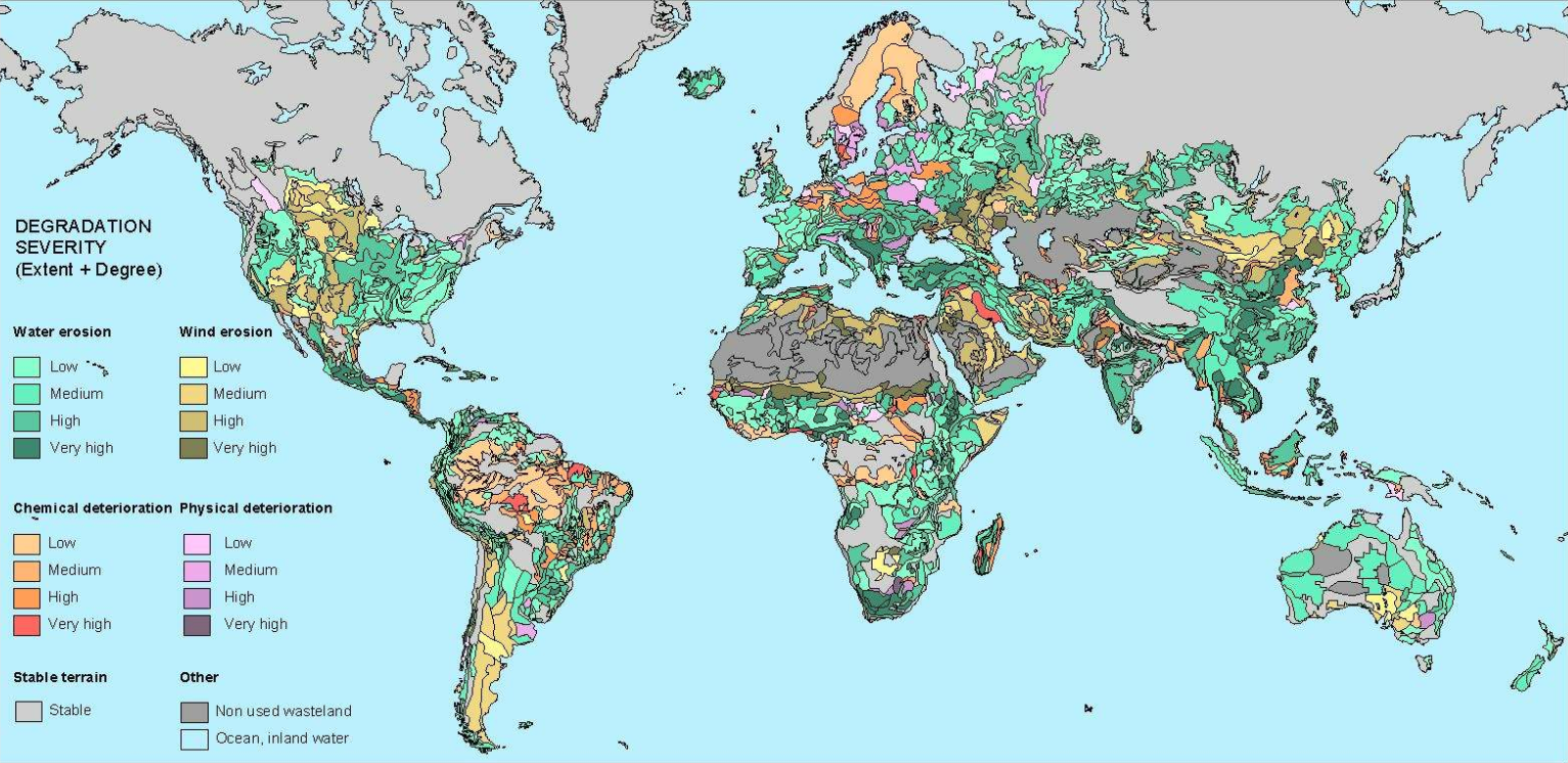
The GLASOD project (1987-1990), carried out for UNEP, has produced a world map of human-induced soil degradation. Data were compiled in cooperation with a large number of soil scientists throughout the world, using uniform Guidelines and international correlation. The status of soil degradation was mapped within loosely defined physiographic units (polygons), based on expert judgement. The type, extent, degree, rate and main causes of degradation have been printed on a global map, at a scale of 1:10 million, and documented in a downloadable database. Information about the areal extent of human-induced soil degradation can be found in an explanatory note.
Simple
- Date (Publication)
- 1990-10-01
- Citation identifier
- 9e84c15e-cb46-45e2-9126-1ca38bd5cd22
- Presentation form
- Digital map
- Status
- Completed
- Point of contact
-
Organisation name Individual name Electronic mail address Role ISRIC - World Soil Information
R.T.A. Hakkeling
Author ISRIC - World Soil Information
W .G. Sombroek
Author ISRIC - World Soil Information
Z. Bai
Point of contact
- Theme
-
-
chemical deterioration
-
physical deterioration
-
degradation status
-
-
Stratum
-
-
Soil science
-
-
Region
-
-
Global
-
- Access constraints
- License
- Use constraints
- License
- Other constraints
- Attribution 3.0 International (CC BY 3.0)
- Spatial representation type
- Vector
- Denominator
- 10000000
- Language
- English
- Character set
- UTF8
- Topic category
-
- Geoscientific information
- Begin date
- 1988-01-01
- End date
- 1990-10-01
))
- Reference system identifier
- EPSG / 4326
- Distribution format
-
Name Version zip
Digital transfer options
- OnLine resource
-
Protocol Linkage Name WWW:DOWNLOAD-1.0-ftp--download
https://files.isric.org/public/other/GLASOD.zip Download
WWW:LINK-1.0-http--related
https://isric.org/projects/global-assessment-human-induced-soil-degradation-glasod Project webpage
WWW:LINK-1.0-http--related
http://www.the-eis.com/data/literature/World%20map%20of%20the%20status%20of%20human-induced%20soil%20degradation_1991.pdf Article
- Hierarchy level
- Dataset
- Statement
-
Oldeman LR, Hakkeling RTA and Sombroek WG 1991. World Map of the Status of Human-Induced Soil Degradation: An explanatory Note (rev. ed.), UNEP and ISRIC, Wageningen, https://isric.org/sites/default/files/isric_report_1990_07.pdf
Metadata
- File identifier
- 9e84c15e-cb46-45e2-9126-1ca38bd5cd22 XML
- Metadata language
- English
- Character set
- UTF8
- Hierarchy level
- Dataset
- Hierarchy level name
-
dataset
- Date stamp
- 2025-10-28T11:40:22
- Metadata standard name
-
ISO 19115:2003/19139
- Metadata standard version
-
2003/Cor.1:2006
- Metadata author
-
Organisation name Individual name Electronic mail address Role ISRIC - World Soil Information
Data infodesk
Point of contact
)))
