SOTER-based soil parameter estimates (SOTWIS) for Senegal and The Gambia
This harmonized set of soil parameter estimates for Senegal and The Gambia. It was derived from the Soil and Terrain Database for Senegal and The Gambia (SENSOTER ver. 1.0) and the ISRIC-WISE soil profile database, using standardized taxonomy-based pedotransfer (taxotransfer) procedures.
The land surface of the study area, covering some 200 800 km2, has been characterized using 149 unique SOTER units. Each SOTER unit consists of up to four different soil components. In so far as possible, each soil component has been characterized by a regionally representative profile, selected and classified by national soil experts. Conversely, in the absence of any measured legacy data, soil components were characterized using synthetic profiles for which only the FAO-Unesco (1988) classification is known.
Soil components in SENSOTER have been characterized using 90 profiles of which 34 are synthetic. The latter represent some 37 per cent of the territory. Comprehensive sets of measured attribute data are not available for most of the measured profiles (56) collated in SENSOTER. Consequently, to permit modelling, gaps in the soil analytical data have been filled using consistent taxotransfer procedures. Modal soil parameter estimates necessary to populate the taxotransfer procedure were derived from statistical analyses of soil profiles held in the ISRIC-WISE database. The current procedure only considers profiles in WISE that have FAO soil unit names identical to those mapped for SOTER-Senegal (41) and that originate from the Tropics (n= 4510).
Parameter estimates are presented for 18 soil variables by soil unit for fixed depth intervals of 0.2 m to 1 m depth. Thes include: organic carbon, total nitrogen, pH(H2O), CECsoil, CECclay, base saturation, effective CEC, aluminium saturation, CaCO3 content, gypsum content, exchangeable sodium percentage (ESP), electrical conductivity (ECE), bulk density, content of sand, silt and clay, content of coarse fragments (less than 2 mm), and available water capacity (-33 kPa to -1.5 MPa). These attributes have been identified as being useful for agro-ecological zoning, land evaluation, crop growth simulation, modelling of soil carbon stocks and change, and analyses of global environmental change.
The current parameter estimates should be seen as best estimates based on the current selection of soil profiles and data clustering procedure. Taxotransfer rules have been flagged to provide an indication of the confidence in the derived data.
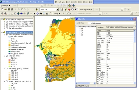
Soil parameter estimates are presented as summary files (in MS-Access format) which can be linked to the SENSOTER map using GIS, through the unique SOTER-unit code (NEWSUID).
The derived (secondary) soil data for Senegal and The Gambia are considered appropriate for exploratory studies at national scale (1:1 million); these should consider the full map unit composition.
Simple
- Date (Publication)
- 2008-11-01
- Citation identifier
- a6320590-0899-4b60-bf4d-f80282bbb72c
- Presentation form
- Digital map
- Status
- Completed
- Point of contact
-
Organisation name Individual name Electronic mail address Role ISRIC - World Soil Information
Niels Batjes
Author
- Theme
-
-
calcium
-
carbon
-
cation exchange capacity
-
electrical conductivity
-
nitrogen
-
organic matter
-
bulk density
-
soil profiles
-
pH
-
salinity
-
texture
-
water holding capacity
-
nutrients
-
-
Stratum
-
-
Soil science
-
-
Region
-
-
Africa
-
Western Africa
-
Senegal
-
Gambia
-
- Access constraints
- License
- Use constraints
- License
- Other constraints
- Attribution 3.0 International (CC BY 3.0)
- Spatial representation type
- Vector
- Denominator
- 1000000
- Language
- English
- Character set
- UTF8
- Topic category
-
- Geoscientific information
- Begin date
- 1956-01-01
- End date
- 2003-01-01
))
- Reference system identifier
- EPSG / 4326
- Distribution format
-
Name Version zip
Digital transfer options
- OnLine resource
-
Protocol Linkage Name WWW:DOWNLOAD-1.0-ftp--download
https://files.isric.org/public/sotwis/SOTWIS_SN_GM.zip Download
WWW:LINK-1.0-http--related
https://isric.org/projects/harmonized-continental-soter-derived-database-sotwis Project webpage
WWW:LINK-1.0-http--related
https://isric.org/sites/default/files/isric_report_2008_05.pdf Report
- Hierarchy level
- Dataset
- Statement
-
This data set:
1) Batjes NH 2008. Soil parameter estimates for Senegal and The Gambia derived from SOTER and WISE (SOTWIS-Senegal, ver. 1.0). Report 2008/05, ISRIC - World Soil Information, Wageningen, , https://isric.org/sites/default/files/isric_report_2008_05.pdf
Source data:
2) Batjes NH 2008. ISRIC-WISE Harmonized Global Soil Profile Dataset (Version 3.1). Report 2008/02, ISRIC - World Soil Information, Wageningen.
3) Batjes NH, Al-Adamat R, Bhattacharyya T, Bernoux M, Cerri CEP, Gicheru P, Kamoni P, Milne E, Pal DK and Rawajfih Z 2007. Preparation of consistent soil data sets for SOC modelling purposes: secondary SOTER data sets for four case study areas. Agriculture, Ecosystems and Environment 122, 26-34, http://dx.doi.org/10.1016/j.agee.2007.01.005
4) Dijkshoorn JA, van Engelen VWP and Huting JRM 2008. Soil and landform properties for LADA partner countries (Argentina, China, Cuba, Senegal and The Gambia, South Africa and Tunisia), ISRIC – World Soil Information and FAO, Wageningen.
Metadata
- File identifier
- a6320590-0899-4b60-bf4d-f80282bbb72c XML
- Metadata language
- English
- Character set
- UTF8
- Hierarchy level
- Dataset
- Hierarchy level name
-
dataset
- Date stamp
- 2021-07-14T11:51:46
- Metadata standard name
-
ISO 19115:2003/19139
- Metadata standard version
-
2003/Cor.1:2006
- Metadata author
-
Organisation name Individual name Electronic mail address Role ISRIC - World Soil Information
Data infodesk
Point of contact
)))
