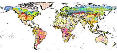
Harmonized World Soil Database (HWSD)
Soil information, from the global to the local scale, has often been the one missing biophysical information layer, the absence of which has added to the uncertainties of predicting potentials and constraints for food and fiber production. The lack of reliable and harmonized soil data has considerably hampered land degradation assessments, environmental impact studies and adapted sustainable land management interventions.
Recognizing the urgent need for improved soil information worldwide, particularly in the context of the Climate Change Convention and the Kyoto Protocol for soil carbon measurements and the immediate requirement for the FAO/IIASA Global Agro-ecological Assessment study (GAEZ v3.0), the Food and Agriculture Organization of the United Nations (FAO) and the International Institute for Applied Systems Analysis (IIASA) took the initiativeof combining the recently collected vast volumes of regional and national updates of soil information with the information already contained within the 1:5,000,000 scale FAOUNESCO Digital Soil Map of the World, into a new comprehensive Harmonized World Soil Database (HWSD).
This database was achieved in partnership with:
• ISRIC-World Soil Information together with FAO, which were responsible for the development of regional soil and terrain databases and the WISE soil profile database;
• the European Soil Bureau Network, which had recently completed a major update of soil information for Europe and northern Eurasia, and
• the Institute of Soil Science, Chinese Academy of Sciences which provided the recent 1:1,000,000 scale Soil Map of China.
Simple
- Date (Publication)
- 2012-02-01
- Citation identifier
- bda461b1-2f35-4d0c-bb16-44297068e10d
- Presentation form
- Digital map
- Status
- Completed
- Point of contact
-
Organisation name Individual name Electronic mail address Role Joint Research Centre of the European Commission - European Soil Data Centre (ESDAC)
Arwyn Jones
None
Author International Institute for Applied Systems Analysis
Edmar Edmar
None
Author International Institute for Applied Systems Analysis
Guenther Fischer
None
Author ISRIC - World Soil Information
Koos Dijkshoorn
None
Author Joint Research Centre of the European Commission - European Soil Data Centre (ESDAC)
Luca Montanarella
None
Author Food and Agriculture Organization of the United Nations
Monica Petri
Author ISRIC - World Soil Information
Niels Batjes
Author International Institute for Applied Systems Analysis
Sylvia Prieler
None
Author ISRIC - World Soil Information
Vincent van Engelen
None
Author Institute of Soil Science - Chinese Academy of Sciences
Xuezheng Shi
None
Author ISRIC- World Soil Information
Data info desk
Point of contact
- Theme
-
-
soil profiles
-
-
Stratum
-
-
Soil science
-
-
Region
-
-
Global
-
- Access constraints
- License
- Use constraints
- License
- Other constraints
-
Attribution-NonCommercial 3.0 International (CC BY-NC 3.0), https://creativecommons.org/licenses/by-nc/3.0/
- Spatial representation type
- Grid
- Distance
- 30 arc-second
- Language
- English
- Character set
- UTF8
- Topic category
-
- Geoscientific information
- Begin date
- 2008-01-01
- End date
- 2012-02-01
))
- Reference system identifier
- EPSG / 4326
- Distribution format
-
Name Version zip
- Distributor contact
-
Organisation name Individual name Electronic mail address Role FAO
Data info desk
Publisher
Digital transfer options
- OnLine resource
-
Protocol Linkage Name WWW:DOWNLOAD-1.0-ftp--download
https://files.isric.org/public/other/HWSD_v1.21.zip Download
WWW:LINK-1.0-http--related
https://openknowledge.fao.org/server/api/core/bitstreams/149f1562-bf6a-439f-9d3a-eb93940f39cf/content Report
WWW:LINK-1.0-http--related
https://webarchive.iiasa.ac.at/Research/LUC/External-World-soil-database/HTML/ Project webpage
- Hierarchy level
- Dataset
Metadata
- File identifier
- bda461b1-2f35-4d0c-bb16-44297068e10d XML
- Metadata language
- English
- Character set
- UTF8
- Hierarchy level
- Dataset
- Hierarchy level name
-
dataset
- Date stamp
- 2025-02-05T10:01:29
- Metadata standard name
-
ISO 19115:2003/19139
- Metadata standard version
-
2003/Cor.1:2006
- Metadata author
-
Organisation name Individual name Electronic mail address Role ISRIC - World Soil Information
Data infodesk
Point of contact
)))
