WISE derived soil properties on a 0.5 by 0.5 degree global grid, version 3.0
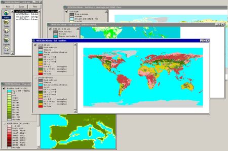
This harmonized, gridded global data set of soil parameter estimates includes files listing: (1) soil parameter estimates for the component soil units of each terrestrial grid cell, in un-binned format, and (2) soil parameter estimates aggregated or binned into a number of predefined classes.
The spatial data, with a resolution of ½ by ½ degree, was derived from the ISRIC-WISE soil database. The land surface between longitudes -180o W and +180o E and latitudes +90o N and -90o S has been characterized using 45948 unique map units; each of these can comprise from one to ten soil units, characterized according to the original legend of the 1:5 million scale Soil Map of the World (FAO-Unesco 1974).
Soil parameter estimates for each of these units were derived from analyses of some 9600 profiles held in a working copy of WISE (ver. 2.0). Twenty-two soil variables, identified as being useful for agro-ecological zoning, land evaluation, crop growth simulation, modelling of soil gaseous emissions and analyses of global environmental change, were considered.
Parameter estimates for the topsoil (0-30 cm) and the subsoil (30-100 cm) are presented for the following variables: content of organic carbon, total nitrogen, the C/N ratio, pH(H2O), CECsoil, CECclay, base saturation, total exchangeable bases, aluminum saturation, exchangeable sodium percentage (ESP), electrical conductivity of saturated paste (ECe), calcium carbonate content, gypsum content, content of sand, silt and clay, content of fragments less than 2 mm, bulk density, total porosity. For soil drainage class, effective soil depth, and available water capacity (-10 to -1500 kPa), however, parameter estimates are presented on a profile basis.
The parameter estimates - median values - presented here should be seen as best estimates; possible types and sources of uncertainty are discussed in the report. The data are considered appropriate for exploratory studies at global scale (greater than 1:5 000 000).
Note: A more recent assessment, at a resolution of 30arcsec (WISE30sec), is available at: http://data.isric.org/geonetwork/srv/eng/catalog.search#/metadata/dc7b283a-8f19-45e1-aaed-e9bd515119bc
Simple
- Date (Publication)
- 2005-12-01
- Citation identifier
- d9eca770-29a4-4d95-bf93-f32e1ab419c3
- Presentation form
- Digital map
- Status
- Completed
- Point of contact
-
Organisation name Individual name Electronic mail address Role ISRIC - World Soil Information
Niels Batjes
Author ISRIC - World Soil Information (WDC - Soils)
Data info desk
Point of contact ISRIC - World Soil Information (WDC - Soils)
Data info desk
Resource provider
- Theme
-
-
calcium
-
carbon
-
cation exchange capacity
-
electrical conductivity
-
nitrogen
-
organic carbon
-
bulk density
-
soil classification
-
soil depth
-
soil profiles
-
pH
-
salinity
-
texture
-
water holding capacity
-
nutrients
-
-
Stratum
-
-
Soil science
-
-
Region
-
-
Global
-
- Access constraints
- License
- Use constraints
- License
- Other constraints
- Attribution 3.0 International (CC BY 3.0)
- Spatial representation type
- Grid
- Distance
- 30 arc-minutes
- Language
- English
- Character set
- UTF8
- Topic category
-
- Geoscientific information
- Begin date
- 1995-08-01
- End date
- 2005-12-01
))
- Reference system identifier
- EPSG / 4326
- Distribution format
-
Name Version zip
- Distributor contact
-
Organisation name Individual name Electronic mail address Role ISRIC - World Soil Information (WDC - Soils)
Data onfo desk
Publisher
Digital transfer options
- OnLine resource
-
Protocol Linkage Name WWW:DOWNLOAD-1.0-ftp--download
https://files.isric.org/public/wise/wise_30min_v3.zip Download
WWW:LINK-1.0-http--related
https://www.isric.org/projects/world-inventory-soil-emission-potentials-wise Project webpage
WWW:LINK-1.0-http--related
https://library.wur.nl/WebQuery/wurpubs/fulltext/286181 Report
- Hierarchy level
- Dataset
- Statement
-
Batjes NH 2005. ISRIC-WISE global data set of derived soil properties on a 0.5 by 0.5 degree grid (ver. 3.0). Report 2005/08, ISRIC - World Soil Information, Wageningen, https://library.wur.nl/WebQuery/wurpubs/fulltext/286181
Metadata
- File identifier
- d9eca770-29a4-4d95-bf93-f32e1ab419c3 XML
- Metadata language
- English
- Character set
- UTF8
- Hierarchy level
- Dataset
- Hierarchy level name
-
dataset
- Date stamp
- 2025-02-05T10:33:05
- Metadata standard name
-
ISO 19115:2003/19139
- Metadata standard version
-
2003/Cor.1:2006
- Metadata author
-
Organisation name Individual name Electronic mail address Role ISRIC - World Soil Information
Data infodesk
Point of contact
)))
