 ISRIC Data Hub
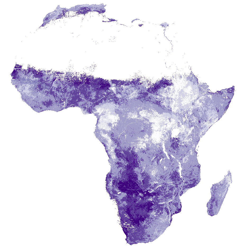
Africa SoilGrids - Texture
Textural class (defined according to USDA system) at 6 depth intervals derived from sand, silt and clay contents predicted using the Africa Soil Profiles Database (AfSP) v1.2. For details see published paper here below (Hengl T., G.B.M. Heuvelink, B. Kempen, J.G.B. Leenaars, M.G. Walsh, K.D. Shepherd, A. Sila, R.A. MacMillan, J. Mendes de Jesus, L.T. Desta, J.E. Tondoh, 2015. Mapping Soil Properties of Africa at 250 m Resolution: Random Forests Significantly Improve Current Predictions. PLoS ONE 10(6)
Texture classes of the USDA system / triangle used in this map:
code, name
1 clay
2 silty clay
3 sandy clay
4 clay loam
5 silty clayloam
6 sandy clay loam
7 loam
8 silty loam
9 sandy loam
10 silt
11 loamy sand
12 sand
Simple
- Date (Publication)
- 2015-02-10
- Identifier
- 2a7d2fb8-e0db-4a4b-9661-4809865aaccf
- Presentation form
- Digital map
- Status
- Completed
- Theme
-
- texture
- digital soil mapping
- Stratum
-
- Soil science
- Region
-
- Africa
- Access constraints
- License
- Use constraints
- License
- Other constraints
- Attribution-NonCommercial 3.0 International (CC BY-NC 3.0), https://creativecommons.org/licenses/by-nc/3.0/
- Spatial representation type
- Grid
- Distance
- 250 m
- Metadata language
- English
- Character set
- UTF8
- Topic category
-
- Geoscientific information
- Begin date
- 1960-01-01
- End date
- 2015-12-31
))
- Reference system identifier
- proj4 / +proj=laea +lat_0=5 +lon_0=20 +x_0=0 +y_0=0 +datum=WGS84 +units=m +no_defs
- Distribution format
-
-
GTiff
(
)
-
GTiff
(
)
- OnLine resource
- Download GeoTIFF at depth 0-5 cm ( WWW:DOWNLOAD-1.0-ftp--download )
- OnLine resource
- Download GeoTIFF at depth 5-15 cm ( WWW:DOWNLOAD-1.0-ftp--download )
- OnLine resource
- Download GeoTIFF at depth 15-30 cm ( WWW:DOWNLOAD-1.0-ftp--download )
- OnLine resource
- Download GeoTIFF at depth 30-60 cm ( WWW:DOWNLOAD-1.0-ftp--download )
- OnLine resource
- Download GeoTIFF at depth 60-100 cm ( WWW:DOWNLOAD-1.0-ftp--download )
- OnLine resource
- Download GeoTIFF at depth 100-200 cm ( WWW:DOWNLOAD-1.0-ftp--download )
- OnLine resource
- Project webpage ( WWW:LINK-1.0-http--related )
- OnLine resource
- Scientific paper ( WWW:LINK-1.0-http--related )
- Hierarchy level
- Dataset
- Statement
-
Project webpages: http://africasoils.net/
http://isric.org/projects/africa-soil-information-service-afsis
Soil data (1): http://isric.org/projects/africa-soil-profiles-database-afsp
Not included: Soil data (2): http://africasoils.net/services/data/soil-databases/
- File identifier
- 2a7d2fb8-e0db-4a4b-9661-4809865aaccf XML
- Metadata language
- English
- Character set
- UTF8
- Hierarchy level
- Dataset
- Hierarchy level name
- dataset
- Date stamp
- 2021-07-14T11:52:34
- Metadata standard name
- ISO 19115:2003/19139
- Metadata standard version
- 2003/Cor.1:2006
Overviews
Spatial extent
Provided by
