 ISRIC Data Hub
SOTER-based soil parameter estimates (SOTWIS) for Central Africa
This harmonized set of soil parameter estimates for Central Africa, comprising Burundi, the Democratic Republic of the Congo and Rwanda, was derived from the Soil and Terrain Database for Central Africa (SOTERCAF ver. 1.0) and the ISRIC-WISE soil profile database, using standardized taxonomy-based pedotransfer (taxotransfer) procedures.
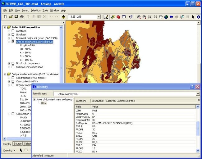
The land surface of Central Africa, comprising some 2.4 million km2, has been characterized using 244 unique SOTER units, corresponding with 504 polygons. Each SOTER unit may consist of up to 6 soil components; each of these has been characterized by a representative profile. The main soil units mapped for the region have been characterized using 167 real profiles, selected by soil experts as being regionally representative for these units. The associated soil analytical data have been derived from soil survey reports.
Gaps in the measured soil data have been filled using a scheme of using a step-wise procedure that uses taxotransfer rules. These rules were developed using some 5672 soil profiles, held in the ISRIC-WISE database, having similar FAO soil unit names as those reported in the primary SOTERCAF database.
Parameter estimates are presented by soil unit for fixed depth intervals of 0.2 m to 1 m depth for: organic carbon, total nitrogen, C/N ratio, pH(H2O), CECsoil, CECclay, base saturation, effective CEC, aluminium saturation, CaCO3 content, gypsum content, exchangeable sodium percentage (ESP), electrical conductivity of saturated paste (ECe), bulk density, content of sand, silt and clay, content of coarse fragments (less than 2 mm), and available water capacity (-33 kPa to -1.5 MPa). These attributes have been identified as being useful for agro-ecological zoning, land evaluation, crop growth simulation, modelling of soil carbon stocks and change, and analyses of global environmental change.
The current parameter estimates should be seen as best estimates based on the current selection of soil profiles and data clustering procedure. Taxotransfer rules have been flagged to provide an indication of the possible confidence in the derived data.
Simple
- Date (Publication)
- 2007-05-01
- Identifier
- 348a9bcc-ca7d-4fe9-ad34-42fed0d0bf52
- Presentation form
- Digital map
- Status
- Completed
- Theme
-
- calcium
- carbon
- cation exchange capacity
- electrical conductivity
- nitrogen
- organic matter
- bulk density
- soil profiles
- pH
- salinity
- texture
- water holding capacity
- nutrients
- Stratum
-
- Soil science
- Region
-
- Africa
- Central Africa
- Rwanda
- Burundi
- DR of the Congo
- Access constraints
- License
- Use constraints
- License
- Other constraints
- Attribution 3.0 International (CC BY 3.0)
- Spatial representation type
- Vector
- Denominator
- 2000000
- Metadata language
- English
- Character set
- UTF8
- Topic category
-
- Geoscientific information
- Begin date
- 1955-01-01
- End date
- 1992-07-01
))
- Reference system identifier
- EPSG / 4326
- Distribution format
-
-
zip
(
)
-
zip
(
)
- OnLine resource
- Download ( WWW:DOWNLOAD-1.0-ftp--download )
- OnLine resource
- Project webpage ( WWW:LINK-1.0-http--related )
- OnLine resource
- Report ( WWW:LINK-1.0-http--related )
- Hierarchy level
- Dataset
- Statement
-
1) Batjes NH 2007. SOTER-based soil parameter estimates for Central Africa - DR of Congo, Burundi and Rwanda(SOTWIScaf, version 1.0). Report 2007/02, ISRIC - World Soil Information, Wageningen, Wageningen, https://isric.org/sites/default/files/isric_report_2007_02.pdf
2) Batjes NH, Al-Adamat R, Bhattacharyya T, Bernoux M, Cerri CEP, Gicheru P, Kamoni P, Milne E, Pal DK and Rawajfih Z 2007. Preparation of consistent soil data sets for SOC modelling purposes: secondary SOTER data sets for four case study areas. Agriculture, Ecosystems and Environment 122: 26-34, http://dx.doi.org/10.1016/j.agee.2007.01.005
3) FAO, ISRIC and UG 2007. Soil and terrain database for central Africa (Burundi and Rwanda 1:1 million scale; Democratic Republic of the Congo 1:2 million scale). Land and Water Digital Media Series 33, Food and Agricultural Organization of the United Nations, ISRIC - World Soil Information and Universiteit Gent, Rome
4) Van Engelen VWP, Verdoodt A, Dijkshoorn JA and Van Ranst E 2006. Soil and Terrain Database of Central Africa (DR of Congo, Burundi and Rwanda). Report 2006/07, ISRIC - World Soil Information, Wageningen,
5) Batjes NH 2008. Mapping soil carbon stocks of Central Africa using SOTER. Geoderma 146, 58-65, http://dx.doi.org/10.1016/j.geoderma.2008.05.006
- File identifier
- 348a9bcc-ca7d-4fe9-ad34-42fed0d0bf52 XML
- Metadata language
- English
- Character set
- UTF8
- Hierarchy level
- Dataset
- Hierarchy level name
- dataset
- Date stamp
- 2021-07-14T11:52:04
- Metadata standard name
- ISO 19115:2003/19139
- Metadata standard version
- 2003/Cor.1:2006
Overviews
Spatial extent
Provided by
