 ISRIC Data Hub
SOTER-based soil parameter estimates (SOTWIS) for the Indo-Gangetic Plains of India
This harmonized set of soil parameter estimates for the Indo-Gangetic Plains (IGP) of India, at scale 1:1 000 000, has been derived from soil and terrain data collated in SOTER format by staff of the National Bureau of Soil Survey and Land Use Planning (NBSS and LUP) at Nagpur, India. The data set has been prepared for use in the project on "Assessment of soil organic carbon stocks and change at ... national scale" (GEFSOC), which has IGP-India as one of its four case study areas (see http://www.nrel.colostate.edu/projects/gefsoc-uk/).
The land surface of IGP-India has been characterized using 36 unique SOTER units, corresponding with 497 polygons. The major soils of these units have been described using 36 profiles, selected by national soil experts as being representative for these units. The associated soil analytical data have been derived from soil survey reports.
Gaps in the measured soil profile data have been filled using a scheme of taxotransfer rules. Parameter estimates are presented by soil unit for fixed depth intervals of 0.2 m to 1 m depth for: organic carbon, total nitrogen, pH(H2O), CECsoil, CECclay, base saturation, effective CEC, aluminum saturation, CaCO3 content, gypsum content, exchangeable sodium percentage (ESP), electrical conductivity of saturated paste (ECe), bulk density, content of sand, silt and clay, content of coarse fragments, and available water capacity(-33 to-1500 kPa). These attributes have been identified as being useful for agro-ecological zoning, land evaluation, crop growth simulation, modelling of soil carbon stocks and change, and analyses of global environmental change.
The current parameter estimates should be seen as best estimates based on the current selection of soil profiles and data clustering procedure; taxotransfer rules have been flagged to provide an indication of the confidence in the derived data.
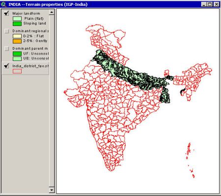
Results are presented as summary files and can be linked to the 1:1M scale SOTER map in a GIS, through the unique SOTER-unit code.
The secondary SOTER data set for IGP-India is considered appropriate for exploratory studies at regional scale (greater than1:1M); correlation of soil analytical data should be done more rigorously when more detailed scientific work is considered.
Simple
- Date (Publication)
- 2004-12-01
- Identifier
- 6eba341b-79d7-4b40-bc19-14a9066f1386
- Presentation form
- Digital map
- Status
- Completed
- Theme
-
- calcium
- carbon
- cation exchange capacity
- electrical conductivity
- nitrogen
- organic matter
- bulk density
- soil profiles
- pH
- salinity
- texture
- water holding capacity
- nutrients
- Stratum
-
- Soil science
- Region
-
- Asia
- India
- Indo-Gangetic Plains
- Access constraints
- License
- Use constraints
- License
- Other constraints
- Attribution 3.0 International (CC BY 3.0)
- Spatial representation type
- Vector
- Denominator
- 1000000
- Metadata language
- English
- Character set
- UTF8
- Topic category
-
- Geoscientific information
- Begin date
- 1950-01-01
- End date
- 2004-12-01
))
- Reference system identifier
- EPSG / 4326
- Distribution format
-
-
zip
(
)
-
zip
(
)
- OnLine resource
- Download ( WWW:DOWNLOAD-1.0-ftp--download )
- OnLine resource
- Project webpage ( WWW:LINK-1.0-http--related )
- OnLine resource
- Report ( WWW:LINK-1.0-http--related )
- Hierarchy level
- Dataset
- Statement
-
1) Batjes NH, Al-Adamat R, Bhattacharyya T, Bernoux M, Cerri CEP, Gicheru P, Kamoni P, Milne E, Pal DK and Rawajfih Z 2007. Preparation of consistent soil data sets for SOC modelling purposes: secondary SOTER data sets for four case study areas. Agriculture, Ecosystems and Environment 112, 26-34, http://dx.doi.org/10.1016/j.agee.2007.01.005
2) Batjes NH, Bhattacharyya T, Mandal C, Dijkshoorn K, Pal DK, Milne E and Gajbhiye KS 2004. Soil data derived from SOTER for studies of carbon stocks and change in the Indo-Gangetic Plains (India) (ver. 1.0; GEFSOC Project). Report 2004/06, ISRIC - World Soil Information and NBSS and LUP (ICAR, India), Wageningen,https://isric.org/sites/default/files/isric_report_2004_06.pdf (this data set)
3) Bhattacharyya T, Pal DK, Easter M, Batjes NH, Milne E, Gajbhiye KS, Chandran P, Ray SK, Mandal C, Paustian K, Williams S, Killian K, Coleman K, Falloon P and Powlson D 2007. Modelled soil organic carbon stocks and changes in the Indo-Gangetic Plains, India, between 2000 and 2030. Agriculture, Ecosystems and Environment 112, 84-94, http://dx.doi.org/10.1016/j.agee.2007.01.010
4) Chandran P, Bhattacharyya T, Ray SK, Durge SL, Mandal C, Sarkar D, Sahoo AK, Singh SP, Jagat Ram, Ram Gopal, Pal DK, Gajbhiye KS, Milne E, Aurangabadker B, Mendhekar P and Singh B 2005. Soil and terrain digital databases for IGP, India. Special Publication for Assessment of Soil Organic Carbon Stocks and Change at National Scale, National Bureau for Soil Survey and Land Use Planning (NBSS and LUP), Nagpur
- File identifier
- 6eba341b-79d7-4b40-bc19-14a9066f1386 XML
- Metadata language
- English
- Character set
- UTF8
- Hierarchy level
- Dataset
- Hierarchy level name
- dataset
- Date stamp
- 2021-07-14T11:52:11
- Metadata standard name
- ISO 19115:2003/19139
- Metadata standard version
- 2003/Cor.1:2006
Overviews
Spatial extent
Provided by
