 ISRIC Data Hub
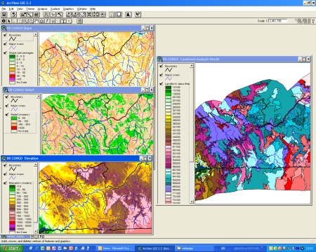
Soil and Terrain Database for Central Africa (SOTERCAF)
The Soil and Terrrain database of Central Africa (SOTERCAF, version 1.0) was compiled at scale 1:2 million for the Democratic Republic of Congo and at scale 1:1 million for Rwanda and Burundi. The SOTERCAF compilation has been a joint collaboration of the Soil Science Laboratory of the University of Ghent, Belgium and ISRIC - World Soil Information, Wageningen under contract with the Food and Agriculture Organisation of the United Nations. Further assistance is provided by the Department BIOT of the Hogeschool Gent, the Royal Museum for Central Africa (Tervuren) and data holders in the Democratic Republic Congo, Burundi and Rwanda. The project started in September 2005 by deriving physiographic units from SRTM grid data based on SOTER landform definitions. The database was completed in July 2006 after combining the physiographic layer with the lithology and soils layer. The border harmonization with the SOTERSAF database was finalized November 2006.
SOTERCAF forms a part of the ongoing activities of ISRIC, FAO and UNEP to update the world's baseline information on natural resources.The project involved collaboration with national soil institutes from the countries in the region as well as individual experts.
Simple
- Date (Publication)
- 2006-09-01
- Identifier
- aa954c06-2b06-4eb7-8771-8f2216653b94
- Presentation form
- Digital map
- Status
- Completed
- Theme
-
- calcium
- carbon
- cation exchange capacity
- electrical conductivity
- nitrogen
- organic matter
- bulk density
- soil profiles
- pH
- salinity
- texture
- water holding capacity
- nutrients
- Stratum
-
- Soil science
- Region
-
- Rwanda
- Burundi
- DR of the Congo
- Central Africa
- Access constraints
- License
- Use constraints
- License
- Other constraints
- Attribution 3.0 International (CC BY 3.0)
- Spatial representation type
- Vector
- Denominator
- 2000000
- Metadata language
- English
- Character set
- UTF8
- Topic category
-
- Geoscientific information
- Begin date
- 1955-01-01
- End date
- 1992-07-01
))
- Reference system identifier
- EPSG / 4326
- Distribution format
-
-
zip
(
)
-
zip
(
)
- OnLine resource
- Download ( WWW:DOWNLOAD-1.0-ftp--download )
- OnLine resource
- Project webpage ( WWW:LINK-1.0-http--related )
- OnLine resource
- Report ( WWW:LINK-1.0-http--related )
- Hierarchy level
- Dataset
- Statement
-
1) van Engelen VWP, Verdoodt A, Dijkshoorn JA and Van Ranst E 2006. Soil and Terrain Database of Central Africa (DR of Congo, Burundi and Rwanda). Report 2006/07, ISRIC - World Soil Information, Wageningen, https://library.wur.nl/WebQuery/wurpubs/fulltext/44393
2) Batjes NH 2007. SOTER-based soil parameter estimates for Central Africa - DR of Congo, Burundi and Rwanda(SOTWIScaf, version 1.0). Report 2007/02, ISRIC - World Soil Information, Wageningen, Wageningen, https://isric.org/sites/default/files/isric_report_2007_02.pdf
3) Batjes NH, Al-Adamat R, Bhattacharyya T, Bernoux M, Cerri CEP, Gicheru P, Kamoni P, Milne E, Pal DK and Rawajfih Z 2007. Preparation of consistent soil data sets for SOC modelling purposes: secondary SOTER data sets for four case study areas. Agriculture, Ecosystems and Environment 122: 26-34, http://dx.doi.org/10.1016/j.agee.2007.01.005
4) FAO, ISRIC and UG 2007. Soil and terrain database for central Africa (Burundi and Rwanda 1:1 million scale; Democratic Republic of the Congo 1:2 million scale). Land and Water Digital Media Series 33, Food and Agricultural Organization of the United Nations, ISRIC - World Soil Information and Universiteit Gent, Rome
5) Goyens C, Verdoodt A, Wauw J van de, Baert G, Engelen VWP van, Dijkshoorn JA and Ranst E van 2007. Base de données numériques sur les sols et le terrain (SOTER) de lAfrique Centrale (RD Congo, Rwanda et Burundi). Etude et Gestion des Sols, 14: 207-218, http://www.inra.fr/internet/Hebergement/afes/EGS/
6) Batjes NH 2008. Mapping soil carbon stocks of Central Africa using SOTER. Geoderma 146, 58-65, http://dx.doi.org/10.1016/j.geoderma.2008.05.006
- File identifier
- aa954c06-2b06-4eb7-8771-8f2216653b94 XML
- Metadata language
- English
- Character set
- UTF8
- Hierarchy level
- Dataset
- Hierarchy level name
- dataset
- Date stamp
- 2021-07-14T11:52:37
- Metadata standard name
- ISO 19115:2003/19139
- Metadata standard version
- 2003/Cor.1:2006
Overviews
Spatial extent
Provided by
