 ISRIC Data Hub
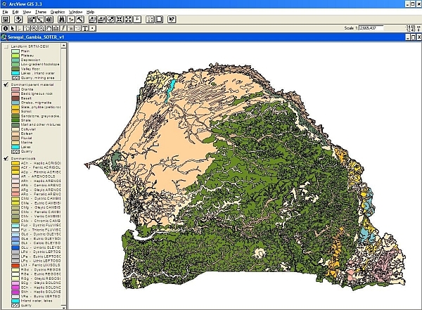
Soil and Terrain Database (SOTER) for Senegal and the Gambia
The Soil and Terrain database for Senegal and The Gambia primary data (version 1.0), at scale 1:1 million (SOTER_Senegal_Gambia), was compiled of enhanced soil information within the framework of the FAO's program Land Degradation Assessment in Drylands (LADA). Primary soil and terrain data for Senegal were obtained through the Institut National de Pédologie Dakar; the digital soil map from the Centre de Suivi Ecologique. Adjustments made in the SOTER units were based on the SRTM-DEM derived data interpretations.
SOTER forms a part of the ongoing activities of ISRIC, FAO and UNEP to update the world's baseline information on natural resources.The project involved collaboration with national soil institutes from the countries in the region as well as individual experts.
Simple
- Date (Publication)
- 2008-10-01
- Identifier
- dcc5e339-149d-49b4-8163-16a710446dd5
- Presentation form
- Digital map
- Status
- Completed
- Theme
-
- calcium
- carbon
- cation exchange capacity
- electrical conductivity
- nitrogen
- organic matter
- bulk density
- soil profiles
- pH
- salinity
- texture
- water holding capacity
- nutrients
- Stratum
-
- Soil science
- Region
-
- Africa
- Western Africa
- Senegal
- Gambia
- Access constraints
- License
- Use constraints
- License
- Other constraints
- Attribution 3.0 International (CC BY 3.0)
- Spatial representation type
- Vector
- Denominator
- 1000000
- Metadata language
- English
- Character set
- UTF8
- Topic category
-
- Geoscientific information
- Begin date
- 1956-01-01
- End date
- 2003-01-01
))
- Reference system identifier
- EPSG / 4326
- Distribution format
-
-
zip
(
)
-
zip
(
)
- OnLine resource
- Download ( WWW:DOWNLOAD-1.0-ftp--download )
- OnLine resource
- Project webpage ( WWW:LINK-1.0-http--related )
- OnLine resource
- Report ( WWW:LINK-1.0-http--related )
- Hierarchy level
- Dataset
- Statement
-
Primary data:
1) Dijkshoorn JA, van Engelen VWP and Huting JRM 2008. Soil and landform properties for LADA partner countries (Argentina, China, Cuba, Senegal and The Gambia, South Africa and Tunisia). ISRIC report 2008/06 and GLADA report 2008/03, ISRIC – World Soil Information and FAO, Wageningen,
https://isric.org/sites/default/files/isric_report_2008_06.pdf
2) Secondary data (needed for modelling):
Batjes NH 2008. Soil parameter estimates for Senegal and The Gambia derived from SOTER and WISE (SOTWIS-Senegal, ver. 1.0). Report 2008/05, ISRIC - World Soil Information, Wageningen, https://isric.org/sites/default/files/isric_report_2008_05.pdf
- File identifier
- dcc5e339-149d-49b4-8163-16a710446dd5 XML
- Metadata language
- English
- Character set
- UTF8
- Hierarchy level
- Dataset
- Hierarchy level name
- dataset
- Date stamp
- 2021-07-14T11:51:55
- Metadata standard name
- ISO 19115:2003/19139
- Metadata standard version
- 2003/Cor.1:2006
Overviews
Spatial extent
Provided by
