 ISRIC Data Hub
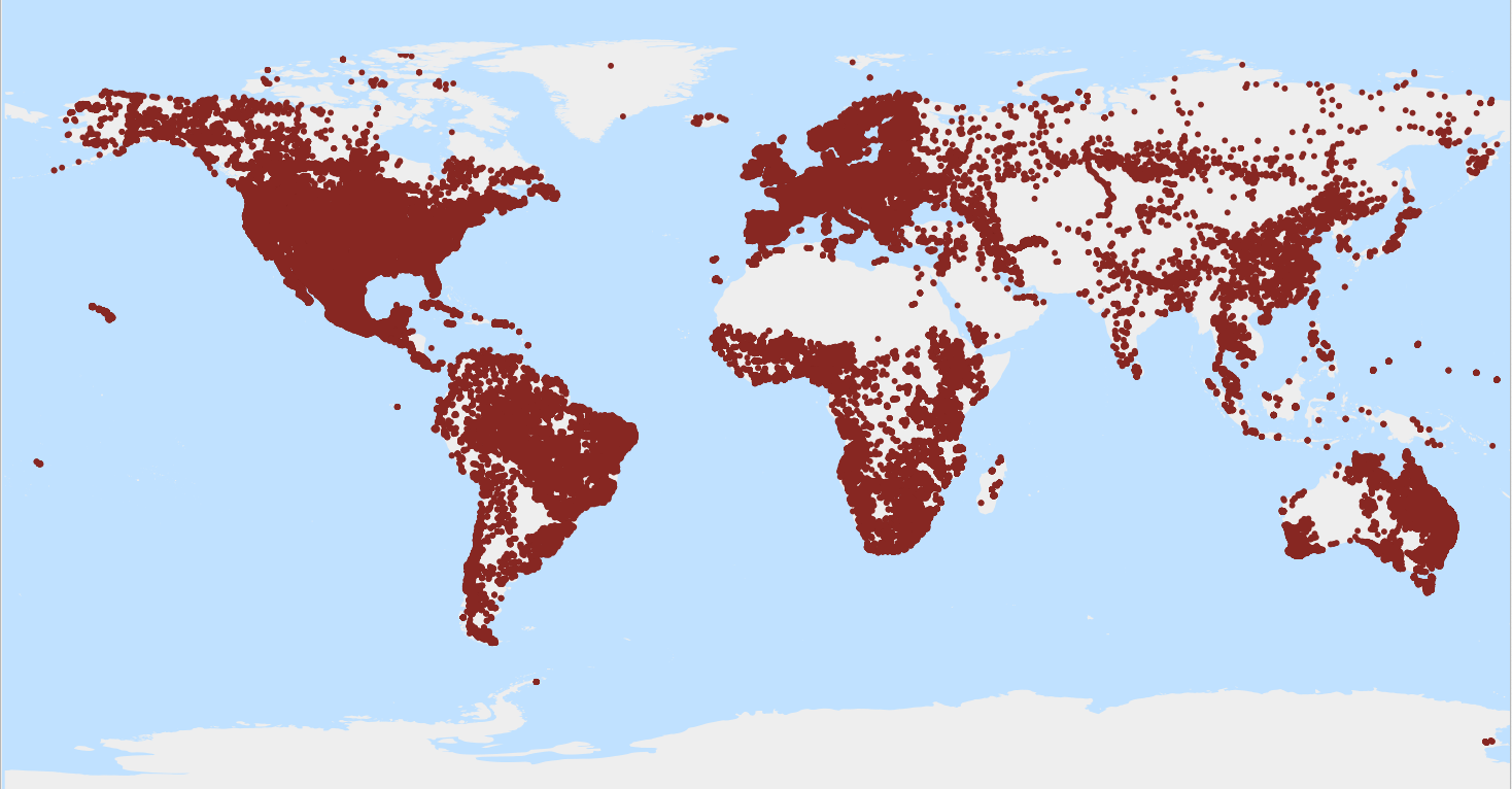
WoSIS latest - Profiles
Provides key information for all profiles (or point data) in WoSIS latest, including soil classification according to specified edition (year) of the World Reference Base for Soil Resources (WRB, up to qualifier level); FAO-Unesco Legend (up to soil unit level); USDA Soil Taxonomy (up to subgroup level).
WoSIS_latest is a 'dynamic dataset' that contains the most recent complement of quality-assessed and standardised soil data served from WoSIS (ISRIC World Soil Information Service). The source data were shared by a wide range of data providers (see: https://www.isric.org/explore/wosis/wosis-contributing-institutions-and-experts ).
Being dynamic, the contents of 'wosis_latest' will change once new point data are acquired, cleansed and standardised, additional soil properties are considered, and/or when possible amendments are required.
Static snapshots of 'wosis_latest' are released at irregular intervals for consistent citation purposes and to discuss methodological changes; the last snapshot is available at https://doi.org/10.5194/essd-16-4735-2024.
For general information about WoSIS please see the FAQ-page at https://www.isric.org/explore/wosis/faq-wosis.
Simple
- Date (Publication)
- 2020-05-01
- Identifier
- f41367e5-f4d2-4b73-81aa-a472730e1519
- Presentation form
- Digital map
- Status
- On going
- Theme
-
- soil profiles
- soil classification
- soil profiles
- Stratum
-
- Soil science
- Region
-
- Global
- Access constraints
- License
- Use constraints
- License
- Other constraints
- Licenced per profile, as specified by data provider and indicated in the data
- Spatial representation type
- Vector
- Denominator
- 100000
- Metadata language
- English
- Character set
- UTF8
- Topic category
-
- Geoscientific information
- Begin date
- 1918-01-01
- End date
- 2013-02-12
))
- Reference system identifier
- EPSG / 4326
- Distribution format
-
-
CSV
(
)
-
CSV
(
)
- OnLine resource
-
:wosis_latest_profiles
(
OGC:WFS
)
WoSIS latest - Profiles
- OnLine resource
- Scientific paper ( WWW:LINK-1.0-http--related )
- OnLine resource
- Project webpage ( WWW:LINK-1.0-http--related )
- OnLine resource
-
wosis_latest_profiles
(
OGC:WMS
)
WoSIS latest - Profiles
- Hierarchy level
- Dataset
- File identifier
- f41367e5-f4d2-4b73-81aa-a472730e1519 XML
- Metadata language
- English
- Character set
- UTF8
- Hierarchy level
- Dataset
- Hierarchy level name
- dataset
- Date stamp
- 2024-11-26T15:32:13
- Metadata standard name
- ISO 19115:2003/19139
- Metadata standard version
- 2003/Cor.1:2006
Overviews
Spatial extent
Provided by
